Auto-encoder satellite image generator
A downloadable demo for Windows
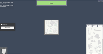
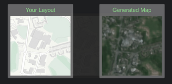
This is a prototype project primarily exploring the use of Unity engine as a platform for running TensorFlow models. The project acts as a tool for generating satellite style images from designs that you create by dragging and dropping modular snippets.
The project makes use of the TensorFlowSharp plugin for Unity, I believe this has been discontinued now- the version I used was already far outdated. You can however find the original version of TFSharp here (not the Unity plugin) => https://github.com/migueldeicaza/TensorFlowSharp.
The model itself is a convolutional auto-encoder, trained on map data to produce satellite equivalents of user created designs. This doesn't sound at all very useful ;) but the point is rather to explore the potential of the use of machine-learning in aiding creative tasks such as stylization; by allowing a user to easily design something and have a computer do the heavy lifting.
At least this is the premise, the model does a fairly poor job at producing convincing satellite images (I have some idea of why).
| Status | Prototype |
| Category | Tool |
| Platforms | Windows |
| Author | Kaisei Dev |
| Tags | demo, machine-learning, software |
Download
Install instructions
To run the demo, simply unzip the folder and run the executable file called "MapGenAutoencoder".


Leave a comment
Log in with itch.io to leave a comment.